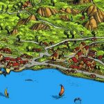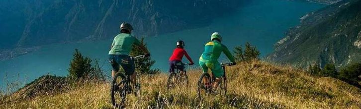
Biking itinerary on lake garda: from Brenzone di Magugnano to Prada
The itinerary starts out in Magugnano, a hamlet of Brenzone. Take the Gardesana road north for approximately 400 meters, then turn right and follow the signs for Castello. The ascending road passes the village of Bocine and flanks the typical terraced olive groves. After 2 km, the biker will reach reach the hamlet of Castello and pass the church: a slight descent takes you to the intersection for Prada. Now comes a hard, steady climb for 7 grueling kilometers.
After the tough ascent, you’ll reach the Costone di Trovai rest area. Further ahead, at the bottom of the valley, you can take a refreshing sip of cool spring water at the “Trovai Grottos” just below the road. Now, in the easiest stretch of the itinerary, you’ll arrive at the Prada plateau where you’ll enjoy the slight descent amidst the pastures. At kilometer 11.60
you’ll arrive at the “Da Tano” trattoria. Follow the signs on the right for Castello, trail nr. 33. Now comes one of the toughest and most technical downhill sections. At a rest area you’ll bear left. After half a kilometer from the beginning of the trail, you’ll bear right and keep following trail nr. 33. The descent is truly a psychological and physical challenge, and
in some points, only the bravest (or luckiest) are able to survive unscathed.
After 14.3 kilometers, you’ll reach the small S. Antonio church. Do not take the side road to the left. Once you reach a large house with a capital, flank the house and go straight on trail nr. 31. When you come across a group of homes, leave the main road and turn left on to the narrow trail that leads to the asphalted road. The descending road will take you back to your point of departure.
INFO
Zone: Prada
Map: KOMPASS K102.
Access: Gardesana orientale S.S. n. 249.
Departure: parking lot of the church in Magugnano di Brenzone.
Length: 17.90 km.
Maximum altitude: 1,135 m.
Total difference in height: 1,065 m.
Time: 2 hours 30 minutes – 4 hours.
Bikability: total; difficult descent.
Beauty (1-5*): ***.
Difficulty: very difficult.
Base: Prada.
Note: the itinerary requires training due to the ascent, but also the descent should not be underestimated.
Recommended for athletes who like technical descents.
Text: Claudio Kerschbaumer
– Useful Advice:
Mountain hiking or trekking is an adventure and an experience that brings you in contact with the mountains and nature. Since some itineraries can be difficult for an amateur or untrained excursionist or mountain climber, caution is advised.
– Clothing:
Clothing must not be exaggerated and always suitable for the season, taking into account the type of excursion, altitude and weather, which can change quickly in the mountains. Bring in your backpack sunglasses, a hat, a change of clothing, waterproof jacket with hood (the change of clothing, be it heavy or light, should depend upon the season underway).
– Equipment:
Besides wearing the right shoes (mountain or trekking boots), bring a water bottle or another beverage, a first aid emergency kit, maps, and a Swiss Army knife.
– Safety:
Always notify someone of your excursion, and if you are not accompanied by family members or friends, speak with the staff at the reception desk in your residence or hotel, and let them know of your plans. Bringing a mobile phone with you during the excursion is very helpful and might come in handy.
These measures might seem extreme, but there are many potential dangers in the mountains, and you want to avoid them. In fact, it is better to be safe than sorry!
Galleria Mountainbike